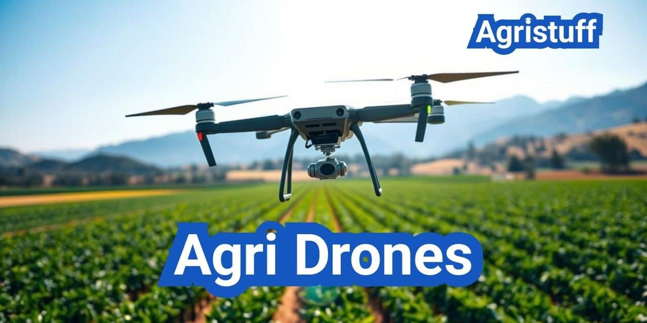
The use of drone technology in agriculture is revolutionizing the way farmers manage their crops and land. The agricultural drone market is projected to grow to $18.22 billion by 2030, with a CAGR of 20.3%. This growth is driven by the increasing adoption of precision agriculture techniques.
Agricultural drones are equipped with advanced sensors and cameras, enabling farmers to monitor crop health, detect issues early, and optimize yields. As the industry continues to evolve, understanding the basics of agri drones, including their applications and regulatory compliance, is crucial for farmers and agricultural businesses in the U.S.
Key Takeaways
- The agricultural drone market is projected to reach $18.22 billion by 2030.
- Drones are being increasingly used for precision agriculture techniques.
- Understanding agri drone basics is crucial for U.S. farmers and agricultural businesses.
- Agricultural drones are equipped with advanced sensors and cameras.
- Regulatory compliance is a key aspect of agri drone adoption.
Understanding Agricultural Drones
In recent years, the use of drones in agriculture has seen significant growth, transforming the way farmers manage their crops. Agricultural drones have become a vital tool for farmers, providing valuable data and insights that enhance crop yields and reduce operational costs.
What Are Agri Drones?
Agri drones, also known as unmanned aerial vehicles (UAVs), are specialized drones designed for agricultural applications. These drones are equipped with various sensors, cameras, and other technology that enable farmers to monitor and manage their crops more effectively. Agri drones can capture high-resolution images, collect data on crop health, and even apply fertilizers or pesticides.
Evolution of Drone Technology in Farming
The use of drones in agriculture dates back to the early 2000s, but it wasn’t until recent advancements that they became more accessible and affordable for farmers. The evolution of drone technology has led to significant improvements in farming practices, including more precise crop monitoring, reduced chemical usage, and enhanced decision-making capabilities. As drone technology in agriculture continues to advance, we can expect to see even more innovative applications in the future.
The integration of UAV technology in agriculture has opened up new possibilities for farmers, from crop scouting to precision agriculture. By leveraging the data collected by these drones, farmers can make more informed decisions, optimize their resources, and ultimately improve their bottom line.
Types of Agri Drones for Different Farm Applications

Agri drones are not one-size-fits-all; they come in different types suited for different farm tasks. The versatility in design and functionality allows farmers to choose the most appropriate drone for their specific needs, whether it’s for mapping, scouting, spraying, or other agricultural applications.
Mapping and Imaging Drones
Mapping and imaging drones are equipped with high-resolution cameras and sensors that capture detailed images of the farm. These drones are used for:
- Creating detailed topographic maps
- Monitoring crop health through NDVI (Normalized Difference Vegetation Index) imaging
- Identifying issues such as irrigation problems or pest infestations
Fixed-wing drones are particularly effective for large-scale mapping operations due to their ability to cover extensive areas. On the other hand, multirotor drones offer greater maneuverability, making them ideal for smaller, more complex areas or for capturing detailed close-up imagery.
Spraying and Application Drones
Spraying drones are designed for precision application of pesticides, fertilizers, and other substances. They are equipped with spray tanks and nozzles that can be controlled to deliver the exact amount needed.
- Reducing chemical usage through targeted application
- Increasing efficiency by covering large areas quickly
- Minimizing human exposure to potentially hazardous chemicals
The use of spraying drones in agriculture has gained popularity due to their ability to navigate challenging terrain and apply substances with high precision.
Multifunctional Agricultural Drones
Some agricultural drones are designed to be multifunctional, capable of performing a variety of tasks such as mapping, scouting, and spraying. These drones offer farmers the flexibility to adapt to different farming needs throughout the growing season.
The development of multifunctional drones represents a significant advancement in agricultural technology, providing farmers with versatile tools that can be used across various applications.
Key Benefits of Implementing Agri Drone Technology
Agri drones are transforming the farming landscape by offering numerous benefits to farmers. The integration of drone technology in agriculture has shown promising results in improving crop yields, reducing chemical usage, and enhancing overall farm management.
Time and Labor Efficiency
One of the significant advantages of agri drones is their ability to improve time and labor efficiency. Drones can quickly survey large areas of land, reducing the time and manpower required for crop monitoring and management. This allows farmers to allocate resources more effectively and respond promptly to any issues that may arise.
Efficient data collection is a critical aspect of this benefit, as drones equipped with high-resolution cameras and sensors can gather detailed information about crop health, growth, and development.
Precision Application and Resource Conservation
Agri drones enable precision application of resources such as fertilizers, pesticides, and irrigation. By targeting specific areas that require treatment, farmers can reduce waste and minimize environmental impact. This precision agriculture approach not only conserves resources but also helps in maintaining soil health and reducing the environmental footprint of farming operations.
Studies have shown that the use of agri drones can lead to a reduction in chemical usage by up to 30%, contributing to more sustainable agricultural practices.
Data-Driven Decision Making
The data collected by agri drones provides farmers with valuable insights into their crops and fields, enabling data-driven decision making. By analyzing drone-collected data, farmers can identify trends, predict potential issues, and make informed decisions about planting, harvesting, and crop management.
This data-driven approach can lead to improved crop yields, with some studies indicating an increase of up to 25% in crop yields through the use of agri drones.
Getting Started with Agri Drone Mapping

To leverage the benefits of agri drone mapping, farmers must first understand the equipment and techniques involved. Drone mapping has become a crucial tool in modern agriculture, providing detailed insights into crop health, soil conditions, and field variability.
Essential Equipment for Drone Mapping
The first step in getting started with agri drone mapping is selecting the right equipment. This includes a drone capable of carrying a suitable camera or sensor, such as those used for NDVI (Normalized Difference Vegetation Index) drone mapping or multispectral imaging.
“The choice of drone and sensor depends on the specific requirements of the farm, including the type of crops, field size, and desired data output,” says John Smith, an agricultural technology expert.
Planning Your First Mapping Mission
Once the equipment is in place, the next step is to plan the drone mapping mission. This involves determining the flight path, altitude, and overlap between images to ensure comprehensive coverage of the field.
- Define the area to be mapped
- Set the appropriate flight altitude and speed
- Ensure sufficient battery life for the mission
Processing and Analyzing Mapping Data
After the drone mapping mission is complete, the collected data needs to be processed and analyzed. This involves using specialized software to stitch the images together, creating an orthomosaic map, and then analyzing the data for insights into crop health and field conditions.
The analysis can reveal critical information, such as variations in soil moisture, nutrient deficiencies, and pest or disease presence, allowing for precision agriculture practices that can significantly improve crop yields and reduce waste.
“The use of drone mapping in agriculture has revolutionized our ability to monitor and manage crops. It’s a game-changer for precision farming,” – Jane Doe, Precision Agriculture Specialist.
Advanced Agri Drone Mapping Techniques
Agricultural drone mapping has reached new heights with the introduction of advanced techniques that provide farmers with more detailed and actionable insights into their fields.
NDVI and Multispectral Imaging
One of the most significant advancements in agri drone mapping is the use of NDVI (Normalized Difference Vegetation Index) and multispectral imaging. NDVI drone mapping allows farmers to assess crop health by measuring the reflectance of light from the plants. This technique is crucial for identifying crop stress and nutrient deficiencies early on.
Multispectral ag drones equipped with specialized sensors capture images across various spectral bands, providing data that goes beyond visual inspection. This enables farmers to detect issues that are not visible to the naked eye, such as water stress or pest infestations.
Creating Orthomosaic Maps for Agriculture
Drone orthomosaic agriculture mapping involves stitching together multiple images captured by drones to create a highly accurate and detailed map of the farm. This drone orthomosaic agriculture technique corrects for distortions, providing a true representation of the field.
Orthomosaic maps are invaluable for planning and managing agricultural operations. They can be used to measure field boundaries, monitor crop growth, and identify areas that require specific attention.
Developing Variable-Rate Prescription Maps
The data collected from advanced drone mapping techniques can be used to create variable-rate prescription maps. These maps guide farming equipment to apply inputs such as fertilizers, pesticides, and irrigation at the optimal rate for different areas of the field.
By using variable-rate prescription maps, farmers can optimize their resource application, reduce waste, and improve crop yields. This precision agriculture approach is a significant step forward in sustainable farming practices.
In conclusion, advanced agri drone mapping techniques are transforming the agricultural landscape by providing farmers with the data they need to make informed decisions. As technology continues to evolve, we can expect to see even more innovative applications of drone technology in farming.
Effective Crop Scouting with Agri Drones
Agri drones are revolutionizing crop scouting by providing farmers with precise, real-time data on crop health and field conditions. This technology enables farmers to identify issues early, reduce yield loss, and improve overall farm productivity.
Setting Up Drone Scouting Routines
To effectively use drones for crop scouting, farmers need to establish a regular scouting routine. This involves determining the frequency of flights based on crop type, growth stage, and weather conditions. Drones equipped with high-resolution cameras or multispectral sensors can capture detailed images of the crops, which are then analyzed to identify any stress or disease.
For instance, a farmer growing corn might schedule weekly drone flights during the critical growth stages to monitor for signs of nitrogen deficiency or pest damage. By doing so, they can apply targeted interventions, reducing waste and improving yields.
Identifying Plant Health Issues
Drone-based scouting can detect crop stress and disease early, often before they become visible to the naked eye. By analyzing the data captured by the drone, farmers can identify issues such as:
- Pest infestations
- Disease outbreaks
- Nutrient deficiencies
- Water stress
For example, multispectral imaging can help detect variations in plant health by capturing data on different spectral bands. This information can be used to create detailed maps of the field, highlighting areas that require attention.
Integrating Scouting Data with Farm Management
The data collected from drone scouting can be integrated with farm management systems to inform decision-making. By combining scouting data with other farm data, such as soil type, weather patterns, and yield history, farmers can gain a more comprehensive understanding of their operations.
This integrated approach enables farmers to make data-driven decisions on irrigation, fertilization, and pest control, leading to more efficient and sustainable farming practices.
| Scouting Data Type | Information Provided | Farm Management Application |
|---|---|---|
| Multispectral Imaging | Plant health, stress, and disease | Targeted irrigation and fertilization |
| High-Resolution Imagery | Crop density, growth stage | Yield prediction, crop monitoring |
| Thermal Imaging | Water stress, soil moisture | Irrigation scheduling |
U.S. Regulatory Framework for Agri Drones

The U.S. regulatory framework for agri drones is primarily governed by the Federal Aviation Administration (FAA) under Part 107. This regulation sets the foundation for the safe operation of drones in agricultural settings.
FAA Part 107 Requirements
To operate drones commercially, farmers and agricultural businesses must comply with FAA Part 107 regulations. Key requirements include:
- Obtaining a Remote Pilot Certificate from the FAA
- Operating drones during daylight hours or civil twilight with anti-collision lights
- Maintaining visual line of sight (VLOS) with the drone at all times
- Not exceeding 400 feet above ground level
- Not operating over people not directly involved in the operation
These regulations are designed to ensure safe drone operations while allowing for the efficient use of this technology in agriculture.
Remote ID Compliance for Agricultural Operations
The FAA has introduced Remote Identification (Remote ID) requirements for drones, including those used in agricultural operations. Remote ID is a system that allows drones to transmit identification and tracking information, enhancing safety and security.
| Remote ID Feature | Description |
|---|---|
| Drone Identification | Unique identifier transmitted by the drone |
| Location Information | Drone’s position, altitude, and velocity |
| Operator Information | Details about the drone operator |
Compliance with Remote ID regulations is crucial for agricultural drone operators to avoid potential penalties.
LAANC Authorization for Agricultural Airspace
The Low Altitude Authorization and Notification Capability (LAANC) system is a critical component of the FAA’s drone integration efforts. LAANC provides near real-time airspace authorizations, allowing drone operators to quickly obtain permission to fly in controlled airspace.
For agricultural drone operations, LAANC is particularly useful for:
- Obtaining authorization to fly near airports
- Accessing controlled airspace for complex operations
- Reducing wait times for airspace authorizations
By understanding and complying with these regulations, agricultural drone operators can ensure safe and efficient operations while minimizing the risk of non-compliance.
Compliance Requirements for Spray Drones

Compliance is a critical aspect of spray drone operations, involving certifications, licenses, and adherence to environmental regulations. As the agricultural sector increasingly adopts drone technology for spraying applications, understanding these compliance requirements is essential for safe and effective operation.
Part 137 Certification for Agricultural Aircraft Operations
To operate a spray drone, pilots must comply with the Federal Aviation Administration’s (FAA) Part 137 regulations, which govern agricultural aircraft operations. This certification is crucial for ensuring that drone operations are conducted safely and in accordance with federal guidelines.
- Obtain a Part 137 certificate from the FAA.
- Ensure compliance with all operational requirements outlined in Part 137.
- Maintain accurate records of operations as per FAA regulations.
State Pesticide Applicator Licensing
In addition to federal regulations, spray drone operators must also comply with state-level pesticide applicator licensing requirements. These licenses are typically issued by state departments of agriculture or environmental protection agencies.
Key considerations for state licensing include:
- Understanding the specific licensing requirements for your state.
- Completing any necessary training or certification programs.
- Renewing licenses as required by state regulations.
Environmental Regulations and Best Practices
Spray drone operations must also adhere to environmental regulations designed to protect natural resources and minimize the ecological impact of agricultural practices.
Best practices for environmental compliance include:
- Using precision application techniques to minimize drift and overspray.
- Selecting pesticides and application rates that are appropriate for the target crop and pest.
- Maintaining records of pesticide applications, including rates, dates, and locations.
By understanding and complying with these regulations, spray drone operators can ensure their operations are both effective and environmentally responsible.
Farm Data Privacy and Management Considerations

With the growing reliance on agricultural drones, understanding data privacy and management considerations is essential for successful farm operations. As farmers increasingly adopt drone technology, they must navigate complex issues related to data ownership, security, and integration with existing farm systems.
Ownership of Drone-Collected Agricultural Data
The question of who owns the data collected by agricultural drones is a critical consideration. Farmers must understand their rights and responsibilities regarding the data generated by these devices. Data ownership is not just a legal issue; it affects how farmers can use, share, and monetize their data.
To address data ownership concerns, farmers should:
- Review and understand the terms of service and data policies of their drone manufacturers and service providers.
- Consider data ownership agreements that clearly define rights and responsibilities.
- Be aware of potential data sharing with third parties and the implications for their operations.
Secure Data Storage and Sharing Practices
Ensuring the security of drone-collected data is paramount. Farmers must implement robust data storage and sharing practices to protect their information from unauthorized access, breaches, or other security threats.
Best practices for secure data management include:
| Practice | Description | Benefit |
|---|---|---|
| Encryption | Protecting data both in transit and at rest | Prevents unauthorized data access |
| Access Controls | Limiting who can view or modify data | Reduces risk of data breaches or misuse |
| Regular Backups | Creating copies of critical data | Ensures data recovery in case of loss or corruption |
Integrating Drone Data with Existing Farm Systems
To maximize the value of drone-collected data, farmers must integrate it with their existing farm management systems. This integration enables more informed decision-making and streamlined operations.
Key considerations for integration include:
- Compatibility with existing software and hardware.
- Data standardization to ensure consistency across different sources.
- Training for farm staff to effectively use integrated data.
By addressing these farm data privacy and management considerations, farmers can unlock the full potential of agricultural drone technology, enhancing their operations while protecting their valuable data assets.
Agri Drone Price Analysis in the U.S. Market

Understanding the price dynamics of agri drones is crucial for farmers and agricultural businesses looking to invest in precision farming technology. The cost of these drones can vary significantly based on their features, capabilities, and intended applications.
Entry-Level vs. Professional Agricultural Drones
The U.S. market offers a range of agricultural drones, from entry-level models priced around $1,000 to $5,000, suitable for small-scale farming or hobbyist use, to professional-grade drones that can cost upwards of $20,000 to $100,000 or more, depending on their advanced features and capabilities.
Entry-level drones typically offer basic functionalities such as GPS, HD cameras, and simple flight planning. In contrast, professional drones are equipped with advanced sensors, high-resolution cameras, and sophisticated flight control systems, making them suitable for complex agricultural tasks.
Total Cost of Ownership Analysis
When considering the purchase of an agri drone, it’s essential to look beyond the initial purchase price. The total cost of ownership includes additional expenses such as maintenance, repairs, software subscriptions, and training.
- Maintenance and repairs can add up to 10% of the drone’s purchase price annually.
- Software and data analysis tools may require subscription fees.
- Training for operators can also incur additional costs.
Price Comparison of Popular Models
Some of the popular agri drone models in the U.S. market include those from DJI, senseFly, and Yuneec. DJI’s Agras series and Phantom 4 Pro are widely used for agricultural applications, with prices ranging from $3,000 to over $10,000.
| Model | Price Range | Key Features |
|---|---|---|
| DJI Agras T16 | $5,000 – $7,000 | Spraying capability, high payload |
| DJI Phantom 4 Pro | $1,500 – $3,000 | High-resolution camera, obstacle avoidance |
| senseFly eBee SQ | $2,000 – $4,000 | Multispectral imaging, mapping |
By understanding the different price points and features of agri drones available in the U.S. market, farmers and agricultural professionals can make informed decisions about their investments in drone technology.
Selecting the Right Agri Drone Sprayer

With the increasing adoption of drone technology in agriculture, selecting the right agri drone sprayer has become a critical decision for farmers. The effectiveness of crop spraying operations depends on various factors, including the type of crop, field size, and the specific requirements of the agricultural operation.
When evaluating agri drone sprayers, several key features must be considered to ensure optimal performance and value for investment.
Spray Capacity and Coverage Capabilities
The spray capacity of an agri drone sprayer is a crucial factor that determines how much area can be covered in a single flight. Larger tanks allow for more extensive coverage but may impact the drone’s maneuverability and payload capacity.
- Typical Spray Capacities: Agri drone sprayers usually range from 2 to 20 liters.
- Coverage Area: Some high-capacity models can cover up to 50 acres per hour.
- Efficiency: Advanced models offer variable spray rates to optimize application based on crop density and type.
Nozzle Types and Application Precision
The type of nozzles used in an agri drone sprayer significantly affects the precision and effectiveness of the application. Different nozzle types are designed for specific tasks, such as fine misting for insecticides or coarser droplets for herbicides.
- Standard Nozzles: Suitable for general-purpose spraying.
- Precision Nozzles: Designed for targeted application, reducing drift and waste.
- Adjustable Nozzles: Allow for flexibility in spray pattern and droplet size.
Battery Life and Field Endurance
Battery life is a critical factor for agri drone sprayers, as it determines how long the drone can operate on a single charge. Longer battery life enables more extensive coverage without the need for frequent recharging.
Key Considerations:
- Battery Capacity: Measured in milliampere-hours (mAh), affecting overall flight time.
- Charging Time: Quick charging capabilities can minimize downtime between flights.
- Swappable Batteries: Some models offer the option to swap batteries quickly, enhancing operational efficiency.
By carefully evaluating these factors, farmers can select an agri drone sprayer that meets their specific needs, enhancing the efficiency and effectiveness of their crop spraying operations.
Beyond Visual Line of Sight (BVLOS) in Agriculture

Agricultural drone operations are on the cusp of a significant breakthrough with the implementation of Beyond Visual Line of Sight (BVLOS) capabilities. This advancement promises to revolutionize farming practices by enabling drones to cover larger areas without the need for constant visual monitoring.
Current Regulatory Status for BVLOS Farm Operations
The Federal Aviation Administration (FAA) currently regulates BVLOS operations under strict guidelines. As of now, waivers are required for most BVLOS operations, and operators must demonstrate safety measures to the FAA. The regulatory framework is evolving, with ongoing discussions about expanding BVLOS capabilities in agriculture.
Key regulatory considerations include:
- Obtaining waivers or exemptions for BVLOS operations
- Implementing safety measures such as detect-and-avoid systems
- Complying with FAA guidelines for remote identification
Technology Requirements for BVLOS
To enable BVLOS operations, advanced technologies are necessary. These include:
- Detect-and-avoid systems: crucial for preventing collisions with other aircraft
- Reliable communication links: ensuring continuous data transmission between the drone and the ground station
- Advanced navigation systems: enabling precise flight paths and positioning
Future Outlook for BVLOS in American Agriculture
The future of BVLOS in agriculture looks promising, with potential applications in large-scale farming operations, crop monitoring, and precision agriculture. As regulations evolve and technology improves, we can expect to see increased adoption of BVLOS capabilities, leading to enhanced efficiency and productivity in the agricultural sector.
With the integration of BVLOS, farmers will be able to:
- Monitor larger areas more effectively
- Reduce labor costs associated with manual scouting
- Improve crop yields through timely interventions
Agri Drone Subsidy and Funding Options

The U.S. government and state authorities offer multiple funding avenues for precision agriculture technologies, including agri drones. These financial assistance programs are designed to encourage the adoption of innovative farming practices, enhancing efficiency and productivity while reducing environmental impact.
USDA Programs Supporting Precision Agriculture
The United States Department of Agriculture (USDA) provides various programs to support farmers in adopting precision agriculture technologies, including agri drones. The Natural Resources Conservation Service (NRCS) offers financial assistance through programs like the Environmental Quality Incentives Program (EQIP) and the Conservation Stewardship Program (CSP).
Additionally, the USDA’s National Institute of Food and Agriculture (NIFA) funds research and extension projects that promote the development and adoption of precision agriculture technologies.
| Program | Description | Benefits |
|---|---|---|
| EQIP | Provides financial assistance for conservation practices | Up to 75% cost-share for conservation practices |
| CSP | Supports farmers in maintaining and improving conservation practices | Financial and technical assistance for conservation stewardship |
State-Level Incentives for Agricultural Technology
Many states offer their own incentives for farmers adopting agricultural technology, including agri drones. These incentives can vary widely and may include grants, tax credits, or low-interest loans. For example, some states provide funding for precision agriculture projects through their departments of agriculture or agricultural extension services.
Farmers are advised to check with their state’s agricultural department or local extension office to explore available incentives and eligibility criteria.
Tax Benefits for Farm Technology Investments
Investing in agri drones and other precision agriculture technologies can also provide tax benefits. Farmers may be eligible for accelerated depreciation deductions under the Modified Accelerated Cost Recovery System (MACRS), allowing them to recover the cost of their investment more quickly.
Additionally, some states offer tax credits for investments in agricultural technology. Farmers should consult with a tax professional to understand the specific tax benefits available for their agri drone investments.
By leveraging these subsidy and funding options, farmers can reduce the financial burden of adopting agri drone technology, enhancing their operations’ efficiency and competitiveness.
Professional Agri Drone Services
Professional agri drone services are revolutionizing the way farmers approach crop management, yield optimization, and resource allocation. These services provide farmers with access to advanced drone technology and expertise, enabling them to make data-driven decisions and improve their agricultural practices.
Types of Services Available
Professional agri drone service providers offer a range of services tailored to the specific needs of farmers. These services include:
- Aerial imaging and mapping
- Crop scouting and health monitoring
- Precision application of fertilizers and pesticides
- Variable-rate prescription mapping
- Data analysis and consulting
These services can be customized to fit the specific requirements of different farming operations, from small-scale organic farms to large commercial agricultural enterprises.
Choosing the Right Service Provider
When selecting a professional agri drone service provider, farmers should consider several key factors, including:
- Experience and expertise in agricultural drone operations
- Quality and type of equipment used
- Data processing and analysis capabilities
- Compliance with regulatory requirements
- Customer support and service level agreements
By carefully evaluating these factors, farmers can choose a service provider that meets their specific needs and helps them achieve their agricultural goals.
Cost-Benefit Analysis of Outsourcing vs. Ownership
One of the key decisions farmers face when considering agri drone services is whether to outsource these services or invest in their own drone technology. The following table provides a comparison of the costs and benefits associated with each approach:
| Factor | Outsourcing | Ownership |
|---|---|---|
| Initial Investment | Low | High |
| Operational Expertise | Provided by service provider | Requires in-house expertise |
| Equipment Maintenance | Handled by service provider | In-house responsibility |
| Data Analysis | Often included in service | Requires additional investment |
| Flexibility | High – can scale services as needed | Fixed – based on owned equipment |
By carefully weighing these factors, farmers can make an informed decision that aligns with their operational needs and budget constraints.
Agri Drone Training Pathways
As the use of agri drones becomes more widespread, the need for specialized training programs has never been more critical. Agricultural drone operators require comprehensive training to ensure safe and effective operation.
Essential Skills for Agricultural Drone Operators
Agricultural drone operators must possess a unique combination of technical and practical skills. These include:
- Understanding of drone hardware and software
- Knowledge of aviation regulations and airspace restrictions
- Familiarity with agricultural practices and crop management
- Data analysis and interpretation skills
According to industry experts, “drone operators need to understand the intricacies of both the technology and the agricultural context in which they are operating.” This dual expertise is crucial for maximizing the benefits of agri drone technology.
Certification and Training Programs
Several organizations offer certification and training programs for agricultural drone operators. These programs cover topics such as:
- Drone operation and maintenance
- Aerial data collection and processing
- Regulatory compliance
- Data analysis and application
FAA Part 107 certification is a critical component of commercial drone operation in the United States. This certification ensures that operators understand the regulatory framework governing drone use.
“The future of agriculture is heavily dependent on technology, and drones are at the forefront of this revolution. Proper training is essential for harnessing their potential.” –
Agricultural Industry Expert
Continuing Education Resources
The rapidly evolving field of agricultural drone technology demands ongoing education and training. Operators can stay up-to-date through:
- Industry conferences and workshops
- Online courses and webinars
- Professional associations and networking groups
- Manufacturer-provided training programs
By investing in comprehensive training and continuing education, agricultural drone operators can maximize the benefits of this technology and contribute to the advancement of precision agriculture.
Career Opportunities in Agri Drone Operations
With the increasing use of drones in farming, the need for qualified individuals to operate, analyze, and consult on drone technology is becoming more pressing. The agri drone industry is creating new career paths for professionals looking to leverage technology in agriculture.
Pilot Jobs and Requirements
One of the most direct career opportunities in agri drone operations is becoming a drone pilot. To qualify, individuals typically need to obtain a Remote Pilot Certificate under FAA Part 107, demonstrating their understanding of aviation rules, weather, and drone operation.
Pilot Requirements:
- Obtain FAA Part 107 Remote Pilot Certificate
- Understand agricultural practices and challenges
- Operate drones safely and efficiently
- Analyze and report on drone-collected data
Data Analysis and Consulting Roles
Beyond piloting, there’s a growing demand for professionals who can analyze the data collected by drones and provide actionable insights to farmers. These roles require a combination of agricultural knowledge, data analysis skills, and the ability to interpret complex data sets.
| Role | Key Skills | Responsibilities |
|---|---|---|
| Data Analyst | Data interpretation, agricultural knowledge | Analyze drone data, provide crop health insights |
| Consultant | Precision agriculture, drone technology | Advise on drone implementation, data usage |
Entrepreneurial Opportunities in Agri Drone Services
The rise of agri drones also presents entrepreneurial opportunities for individuals to start their own drone service businesses, offering mapping, scouting, and spraying services to farmers. This path requires not only technical knowledge but also business acumen.
Starting an agri drone service business involves understanding the market, acquiring the necessary equipment, and developing a client base. It’s a challenging but potentially rewarding venture for those with the right mix of technical and business skills.
The Future of Agri Drones in American Agriculture
The future of agri drones in American agriculture is promising, driven by ongoing advancements in agricultural drone technology and increasing adoption in farming practices. As precision agriculture continues to evolve, the role of drones in enhancing farm efficiency and productivity is becoming more significant.
With the integration of advanced technologies such as AI and machine learning, agri drones are poised to revolutionize farming practices. The use of drones for mapping, scouting, and spraying is expected to become more widespread, contributing to the growth of precision agriculture in American agriculture.
As the agricultural industry continues to embrace drone technology, the future of agri drones looks bright. With their potential to improve crop yields, reduce costs, and promote sustainable farming practices, agri drones are set to play a vital role in shaping the future of American agriculture.
FAQ
What are agri drones and how are they used in agriculture?
Agri drones, also known as agricultural drones, are unmanned aerial vehicles (UAVs) used in farming to improve crop yields, monitor plant health, and optimize agricultural practices. They are equipped with various sensors and cameras to collect data on crop conditions, soil moisture, and other factors.
What are the benefits of using agri drones in farming?
The benefits of using agri drones include improved crop monitoring, increased efficiency, reduced costs, and enhanced decision-making capabilities. Agri drones can help farmers detect issues early, optimize irrigation and fertilizer application, and reduce waste.
What types of drones are used in agriculture?
There are several types of drones used in agriculture, including mapping and imaging drones, spraying and application drones, and multifunctional agricultural drones. Each type is designed for specific tasks, such as crop monitoring, precision spraying, or data collection.
How do I choose the right agri drone for my farm?
To choose the right agri drone, consider factors such as the size of your farm, the type of crops you’re growing, and the specific tasks you want the drone to perform. You should also consider the drone’s features, such as camera resolution, flight time, and payload capacity.
What are the regulatory requirements for operating agri drones in the U.S.?
In the U.S., agri drone operations are subject to FAA Part 107 regulations, which require drone pilots to be certified and follow specific guidelines for safe operation. Additionally, drone operators must comply with remote ID regulations and obtain LAANC authorization for certain operations.
How do I ensure compliance with regulations when using agri drones for spraying?
To ensure compliance with regulations when using agri drones for spraying, you must obtain Part 137 certification, hold a state pesticide applicator license, and follow environmental regulations and best practices.
What are the advantages of using NDVI and multispectral imaging with agri drones?
NDVI and multispectral imaging allow farmers to assess crop health, detect issues early, and make data-driven decisions. These techniques provide valuable insights into crop conditions, enabling farmers to optimize their agricultural practices.
How can I integrate drone data with my existing farm management systems?
To integrate drone data with your existing farm management systems, you can use software platforms that support data import and analysis. Many drone manufacturers and third-party providers offer solutions for integrating drone data with farm management systems.
What are the costs associated with owning and operating an agri drone?
The costs associated with owning and operating an agri drone include the initial purchase price, maintenance and repair costs, and ongoing expenses such as battery replacement and training. The total cost of ownership can vary depending on the type and size of the drone.
Are there any subsidies or funding options available for agri drone adoption?
Yes, there are subsidies and funding options available for agri drone adoption, including USDA programs, state-level incentives, and tax benefits. These programs can help offset the costs of purchasing and implementing agri drone technology.
What kind of training is required to operate an agri drone?
To operate an agri drone, you typically need to complete a training program and obtain certification under FAA Part 107. Additionally, many drone manufacturers and service providers offer specialized training and support for agricultural drone operations.
What are the career opportunities in agri drone operations?
Career opportunities in agri drone operations include pilot jobs, data analysis and consulting roles, and entrepreneurial opportunities in agri drone services. As the industry continues to grow, we can expect to see new career paths emerge in this field.
Conclusion of: Agri Drone In USA
Why an agri drone belongs on more U.S. farms
The promise of an agri drone is simple: get eyes on the field fast, turn imagery into decisions, and do it within rules that keep people, aircraft, and crops safe. From quick storm assessments to weekly vigor maps, today’s agri drone workflows compress scouting hours into minutes and convert pixels into actionable prescriptions for irrigation, nitrogen, and pest control. In the U.S., that value must ride alongside compliance—registration, Remote ID, and Part 107—so this guide keeps practicality and legality in the same cab. USDA ERS on digital ag adoption
What an agri drone actually does on a typical farm day
A modern agri drone supports three core tasks: rapid scouting with high-resolution RGB imagery, whole-field mapping to build orthomosaics and vigor indices, and, when properly licensed and approved, targeted applications such as seeding cover crops or crop protection sprays. Each job starts with flight planning to achieve the right ground sample distance (GSD) and overlap, continues with automated flights, and ends with stitching images into maps your agronomy software can interpret. UNL Extension: Getting started with drones in agriculture
How an agri drone turns pictures into agronomy (RGB, multispectral, thermal)
The simplest agri drone carries an RGB camera for stitched overviews, stand counts, emergence checks, drowned-out spots, and hail or wind damage. Multispectral payloads add narrowband sensors (e.g., red edge, NIR) that power vegetation indices like NDVI and NDRE to quantify canopy vigor, variability, and potential nutrient or water stress. Thermal payloads complement this by flagging hot, dry zones and irrigation issues, especially in orchards and specialty crops where canopy temperature reflects stress. Auburn Extension: Vegetation indices primer (NDVI/NDRE)
Mapping that matters: making agri drone flights agronomically useful
To convert agri drone imagery into decisions, aim for consistent altitude, frontlap/sidelap (e.g., ~75–80%), and wind-aware tracks to avoid motion blur, then process to an orthomosaic and vigor layers you can compare week to week. Calibrate exposure and, for multispectral payloads, use reflectance panels and sunshine sensors to make maps comparable over time. The goal is change detection—tracking plant vigor trends and aligning them with soil maps, yield history, and management zones. Texas A&M AgriLife UAS field & processing manual
Agri drone scouting: fast passes, fewer blind spots
The fastest ROI from an agri drone usually comes from scouting: pre-plant drainage checks, emergence gaps, lodged areas, storm tracks, weed escapes on headlands, and disease triangles before they balloon. Multispectral passes help you triage which zones deserve boots-on-the-ground tissue tests or sweep nets—so the drone doesn’t replace scouting; it prioritizes it. For tree fruit, canopy-level passes can highlight stress by row so you can sample precisely where it matters. Penn State Extension: UAV-based crop scouting
Agri drone data isn’t the only data: blend with free NAIP imagery
An agri drone gives you centimeter-level detail, but pairing your field maps with seasonal National Agriculture Imagery Program (NAIP) layers helps you see longer-term patterns at the county scale—sandy rises that always burn hot, depressions that pond, or riparian edges with chronic vigor dips. NAIP offers orthorectified imagery across the U.S. growing season, useful for context and benchmarking the year’s variability. USGS: NAIP overview
Agri drone and farm economics: adoption trends and ROI thinking
Adoption of agri drone workflows tends to rise with farm size because larger acreages compound time savings in scouting and mapping, and because variable-rate inputs deliver bigger absolute returns when applied across many acres. That said, even small farms can justify a modest quadcopter for drainage checks, livestock perimeter inspections, or specialty crop canopy monitoring—especially when imagery informs fewer passes, targeted inputs, and avoided losses. USDA ERS: Precision ag adoption by farm size
U.S. compliance 101: every agri drone used for work is a Part 107 aircraft
In the U.S., flying an agri drone for any non-recreational purpose—scouting a field you manage, imaging for a client, or supporting an ag retail service—puts you under 14 CFR Part 107. That means the remote pilot must pass the FAA knowledge test, register each drone, keep it within visual line of sight, and follow operational limits unless a waiver applies. Night, over-people, and moving-vehicle operations are allowed only if the rule’s specific conditions are met. FAA: Certificated Remote Pilots (Part 107)
Becoming a legal agri drone pilot (and staying current)
If you’ll operate an agri drone commercially, you must earn the FAA Remote Pilot Certificate by getting an FAA Tracking Number (FTN), scheduling and passing the Unmanned Aircraft General – Small (UAG) knowledge test, and applying in IACRA. You’ll also complete recurrent online training every 24 months to keep your aeronautical knowledge current and carry your certificate during operations. FAA: Become a certificated remote pilot
Registering your agri drone and marking it
Every agri drone flown under Part 107 must be registered in the FAA DroneZone and marked with its registration number. Registration is quick, costs a nominal fee, and ties your aircraft to your pilot profile. Keep proof of registration with you when flying and ensure the number is legible on the aircraft—engraved, labeled, or permanent marker. FAA: How to register your drone
Remote ID: the digital license plate your agri drone must broadcast
Most agri drone operations must comply with Remote ID, which requires either a Standard Remote ID drone, a broadcast module, or flying inside an FAA-Recognized Identification Area (FRIA). Remote ID helps law enforcement and the FAA identify drones in flight and is a baseline requirement for the U.S. airspace system as operations scale. FAA: Remote Identification of drones
Airspace, LAANC, and preflight checks for an agri drone
Before flying an agri drone, check airspace and local advisories. If your field is in controlled airspace (e.g., near Class D or E surface areas), request near-real-time authorization through LAANC via an approved UAS Service Supplier. Even in rural areas, TFRs, wildfire restrictions, or special use airspace can affect operations—so make an airspace check part of every preflight. FAA: LAANC overview
B4UFLY: quick situational awareness for any agri drone mission
For line-of-sight awareness of where an agri drone can and cannot fly today, the FAA’s B4UFLY services highlight controlled airspace, critical infrastructure advisories, and nearby restrictions. U.S. pilots can use web or mobile interfaces delivered by FAA-approved providers to confirm a “good-to-go” status before wheels-up. FAA: B4UFLY service
Operations at night and over people: what an agri drone pilot must know
Night operations with an agri drone are allowed under Part 107 if you’ve completed the updated training and equipped anti-collision lighting visible for 3 statute miles; flights over people and moving vehicles require aircraft that meet specific categories or conditions in the rule. If your scenario doesn’t fit the rule, you’ll need an appropriate waiver before flying. FAA: Operations over people & at night
Spraying or spreading? Your agri drone may need Part 137
When an agri drone dispenses substances—crop protection products, plant nutrients, or seed—you enter 14 CFR Part 137 agricultural aircraft operations. In addition to Part 107, many spray operators pursue Part 137 certification and, depending on aircraft weight and operation, may need exemptions or letters of authorization. Start with the FAA’s dedicated guidance for UAS dispensing and build your compliance plan from there. FAA: Part 137 & UAS dispensing chemicals
State pesticide licensing still applies to an agri drone
Even with FAA approvals, an agri drone used to apply pesticides must comply with state pesticide licensing and category requirements. Most states require private or commercial applicator credentials, with additional aerial categories for UAS. Check your state’s pesticide regulatory agency for the exact pathway, exams, and recertification schedule. NPIC: State pesticide regulatory agencies
“The label is the law” also covers agri drone applications
Regardless of platform, an agri drone cannot legally apply a product outside its label directions; federal law makes it a violation to use any registered pesticide in a manner inconsistent with its labeling. Look for “Aerial application” directions, droplet size, buffer zones, drift mitigation, and reentry intervals, and remember that state-specific restrictions can be even tighter. EPA: Introduction to pesticide labels
Weight matters: >55 lb agri drone operations follow a different path
If your agri drone weighs 55 lb or more at takeoff, you’ll typically need relief under the Special Authority for Certain Unmanned Systems (49 U.S.C. 44807) rather than standard Part 107 alone, plus the right operating limitations. Many spray platforms approach weight thresholds when fully loaded, so confirm your maximum takeoff weight and follow the FAA’s heavy-UAS guidance. FAA UAS FAQ: >55 lb and 44807
Data stewardship: treat agri drone imagery like farm data
Imagery from an agri drone can reveal patterns of yield, soil, and management—so treat it like any other sensitive farm dataset. When using cloud tools or sharing with advisors, look for providers that follow the American Farm Bureau’s updated Privacy and Security Core Principles and consider services that have earned Ag Data Transparent certification for contract clarity. Ag Data Transparent: Core Principles
BVLOS on the horizon: what the proposed rule could mean for an agri drone
Many agri drone flights are short and visual line-of-sight, but beyond-visual-line-of-sight (BVLOS) would enable linear surveys of pivots, fencelines, canals, and large blocks without constant repositioning. The FAA’s 2025 BVLOS Notice of Proposed Rulemaking sketches a framework to expand low-altitude BVLOS, which—if finalized—could further streamline agricultural workflows in coming seasons. Federal Register: BVLOS proposed rule (2025)
Field-ready checklist to launch an agri drone program
To stand up an agri drone workflow: (1) choose an aircraft/payload that fits your crops and acreage; (2) earn Part 107 and register the aircraft; (3) ensure Remote ID compliance; (4) define flight templates (altitude, overlap); (5) set a weekly cadence for scouting/mapping; (6) integrate maps into your agronomy software; (7) if applying products, secure Part 137 approvals and state licensing; and (8) document SOPs for safety, maintenance, and data handling. FAA: Getting started with drones
Common pitfalls agri drone pilots can avoid
The biggest gotchas for an agri drone are avoidable: skipping airspace checks, letting firmware lag Remote ID requirements, flying multispectral without reflectance calibration (inconsistent maps), and ignoring label language when spraying (illegal use). Build preflight and postflight checklists, and keep a logbook for maintenance, firmware, battery cycles, and software versions to support safe, repeatable results. FAA Remote Pilot Study Guide (PDF)
Final thought
The right agri drone doesn’t just take pretty pictures—it builds a weekly habit of seeing, measuring, and improving. When paired with good agronomy and compliant operations, you’ll spend less time chasing surprises and more time dialing rate maps, irrigation, and scouting priorities. Start small, standardize your workflow, and scale only after your maps are reliably driving better field decisions. UNL CropWatch: Precision agriculture hub
Sources & References
- FAA: Certificated Remote Pilots (Part 107)
- FAA: Become a certificated remote pilot
- FAA: How to register your drone
- FAA: Remote Identification of drones
- FAA: LAANC overview
- FAA: B4UFLY service
- FAA: Operations over people & at night
- FAA: Part 137 & UAS dispensing chemicals
- FAA UAS FAQ: >55 lb and 44807
- Federal Register: BVLOS proposed rule
- UNL Extension: Getting started with drones in agriculture
- Penn State Extension: UAV-based crop scouting
- Auburn Extension: Vegetation indices primer
- Texas A&M AgriLife: UAS manual
- USGS: NAIP overview
- USDA ERS: Precision ag adoption by farm size
- NPIC: State pesticide regulatory agencies
- EPA: Introduction to pesticide labels
- Ag Data Transparent: Core Principles
- FAA: Getting started with drones

